Sorry about the delays with this post and the forgetfulness this past Friday.
Sooo, a little under a month ago (8/24) my mom took the day off to hike up Hadley Mt. with me before I left for school. I'm not sure what time we left, but we got to the mountain later in the day and the parking lot was more than half full.

Let me give you a little background - my mom is paranoid of ticks. Why you ask? Because ticks = Lyme disease. So a few weeks before we headed out my mom went to
Eastern Mountain Sports (EMS) and got us both some gaiters and some intense bug spray. (I'm going to take a quick moment to mention that I also bought a very nice Garmin Dakota 20 at EMS for about $100 off. EMS and I currently have a very nice, budding friendship). ;D
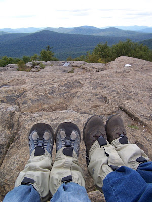
So we pulled off the dirt road and into the tiny parking lot just at the base of the trail head and proceeded to prepare for the hike ahead. We Velcroed and buckled on our gaiters, and sprayed down our pants with DEET bug spray; no ticks are gonna get on US! During this time two other groups pulled in, parked and headed up the trail.
We took a picture at the trail head, signed the log book and finally got started well into noontime. I mentioned in
Into the Sky that I was now equipped with a hiking pole; this is just a simple, old ski pole that no longer has a mate. My dad took off the basket at the bottom and gave it to me to use (it's bright yellow so I can't loose it). Anyways, I gave this to my mom just after we passed the log because I didn't feel like carrying it, she griped a bit at first but was lenient to give it up later. :)
Now
geocaching. My mom is NOT a fan of this, she is convinced that some evil-doer is going to lie in wait at a cache and kidnap me. OK, I admit, it could happen - but anyone who has gone geocaching knows that it most likely won't. So despite her dislike, I came prepared with my Garmin Dakota 20. There are five caches along the Hadley Mt. trail and I intended to find them. One of them I had already found on my last trip up Hadley Mt. with MD and I knew it would be a good example to calm my mom's fears. The first cache is a little ways up the trail and off to the right, unfortunately it was hidden nicely and I wasn't completely used to my new GPS yet so it took me a little while to find it (a fact my Mom was NOT happy with), but find it I did and we continued on up the trail.

My mom is a much slower hiker than I had imagined, but it gave me time to crawl around on the rocks looking for caches. Next was the one I had found with MD and the third was a cache with three parts; you had to find the first cache which contained coordinates to the second which contained coordinates to the third. This multi-cach led you up the trail, stopping fabulous 'resting rocks' and ending just off the trail on the left at a beautiful spot I didn't even know existed! As my quest for these caches continued, my mom began to trust the geocaching pastime a little more. I can only hope that she will accept it more as time goes on.
During all this, we passed many people coming down the mountain; they all assured us with the fact that 'it's worth the hike.' We knew that, but thanked them anyways for their encouragement and plugged on. The day was beautiful, initially we had feared a little bit of rain, but we never got any. :) (MD and I joke that whenever we go hiking it's bad weather, and I'm starting to think it's true. The combination that we make must disturb the atmosphere because I haven't had that problem with anyone else).

There was one more cache on the trail (and one at the summit): the 'Ranger Trail Cache,' it is just off the path on the right. There is the remnants of an old trail that used to be the ranger's trail, a pile of logs lie across the front of it so hikers don't travel down it unawares. I hopped the pile and headed to the coordinates while my mother waited on the trail near the logs (she continuously tells me that rule #1 is: don't leave the trail). This cache eluded me for the longest time, long enough that a group of maybe 6 women hiked up behind us and passed us. They stopped to talk with my mother and were thoroughly interested in what on earth I was doing in the woods. We tried to explain, they wished me luck and headed up the mountain. Unfortunately I couldn't find the stinking cache, so we hiked to the summit and concluded that I would find it on the way down.
The summit was fabulous! Visibility couldn't have been better and there was little to no wind! There is ALWAYS wind on top of Hadley Mt., which makes climbing the fire tower kind of scary at times. Today the tower didn't blow in the wind at all and I had to get a picture of me at the top. (When MD and I went up Hadley Mt. last time it was raining, foggy, cold and windy, and I was not a happy hiker at the top of the tower, so I had to show her I was alive at the top this time). We had our lunch of PBnJ, almonds, water and a flavorful juice box at the base of the tower.

The group of women that had passed us were having their lunch a short ways off and a few of them seemed like avid hikers (my mom said they sounded like school teachers). They were still interested in this 'geocaching thing' and when I went off to look for the cache on the summit they asked me some more questions and watched me wander around looking for benchmarks (the one pictured is kind of boring-looking, but it marks the summit of Hadley Mt.).
Unfortunately I still wasn't completely used to the new GPS, my batteries were dying and I couldn't figure out how to set a heading with relation to the compass. So I gave up and sat back with my mom; Hadley Mt. isn't too far and I know I'll be back soon. A few moments later one of the women came up to me and asked if the cache was a Tupperware container; she had found the Hadley Mt.
letterbox. I don't do letterboxing, but I know a bit about it and I explained it to them. It was really interesting to get to expalin these things to muggles (that's what geocacher's call people who don't know about the pastime) and I think that, since I gave them the geocaching website, they may actually check it out! :)
After a while that group left and my mom and I relaxed at the summit for a little longer before heading back down. When we did I was able to find the cache I had missed before (ugh, looking at something in one wrong angle can really screw things up) and I was definitely pleased with the GPS I had bought the day before.
On the way down we passed three groups heading up. The first was a guy and his dog with what looked like a lawn chair / daypack on his back, the second was a guy who said he takes this hike 2-3 times a week (impressive) and the third was a younger couple. We passed this last group about 15 minutes from the trail head and the girl asked us 'how much further to the top?' We responded with something to the effect of 'about a mile.' They continued on up Hadley Mt., but I'm not so sure that they made it to the summit, it was getting late and they already looked exhausted.

We signed out of the log, tossed our gear into the car and headed to Panera for dinner. Let me tell you, there is nothing like some warm soup and a hearty sandwich after a day of hiking. :) Later, when we got home I handed my GPS to my dad and let him play around with it, and of course he found the application I needed to find the cache on the summit of Hadley Mt.. I was a little annoyed about that, but definitely happy that I now know how to set a new heading. (You'd think this would be easy, but it was hidden at the end of my menu under a strange title that I'm forgetting now).
So for the future: I am planning to hike Hadley Mt. again with my mom some time in October. Robinson, Lauren and I are trying to figure out a weekend that we can go somewhere, and I hope that more outdoors opportunities open up to me during school. Unfortunately MD is out of state for college and unless we make an elaborate feat of planning, we won't be able to do anything until Christmas break (considering she will go hiking in the snow).
Well that's that, I hope it was worth the wait. In
Sticks and Stitches, I mentioned that I would only be posting when things happen, but I'm hoping to keep this thread going despite the lack of outdoor activities. I will find something to fill the empty Fridays for you. :)
Any suggestions for easy, beginner winter hikes?
Peace,
G
 So after our fabulous dance, we headed out to Hadley. Driving down Tower Rd. (the dirt road that the parking lot for the trail head is on) we passed some hunters and mom gave them quite a look, I'm just glad she didn't seem paranoid about getting shot for the rest of the trip! :)
 It had rained a few days the week before and the weather kept telling the high elevation regions to 'watch for snow.' Fortunately we never saw any snow, but we sure saw a lot of water. The trail follows a stream up the mountain for most of the time and it was as high as we had ever seen it. In a few places where it crossed the trail, I got to try out my photography skills ... and my waterproof shoes. Everything went swell and my feet remained dry. :)
 One thing that I just couldn't get over during this hike was the leaves. Not just the colors, but more of the way that the trees changed. Leaf color was so dependent on elevation it was insane! One tree could have no leaves in it's top branches, A few red leaves below that, more yellow below that, and the lots of green near the ground. I know that temperature is a main factor in the leaves changing, but this was fabulous! Or at least I thought it was, being a biology major and all. ;) I hope the first picture and the picture above can do the idea some justice.

 So here's to me hopefully remembering to post this coming Friday and to tell you about my hike with Lauren and Robinson.


